 Creating a new walking trail between San Remo and Inverloch
 was never going to be easy.
By Catherine Watson
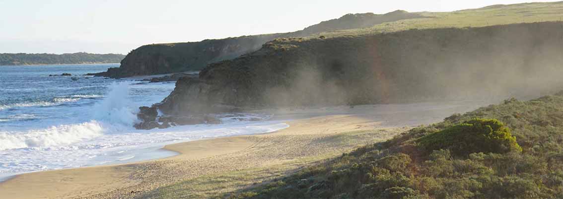
A WALKING and cycling trail connecting San Remo and Inverloch sounds like such a great idea but the first draft of the trail plan gives an inkling of just how difficult it’s going to be to achieve it.
The Yallock-Bulluk walking and cycling trail was a $19.6 million election commitment of the ALP before the 2018 state election.
The draft Yallock-Bulluk plan, released after a year of public consultation and design, focuses on the access and infrastructure required for the trail, including roads, car parks, tracks, boardwalks, toilets, shelters, resting places and signs.
The park and trail are designed to increase the number and type of visitors to Bass Coast and encourage them to stay longer.
Based on similar trails around Australia, the trail could attract around 50,000-60,000 visits each year in the early stages and an additional 232,000 visitors per annum, and 400,000 more overnight stays by 2035.
The constraint is the fragility of the coastal environment and rare ecological communities that could quickly be destroyed by the boots of thousands of happy trampers and cyclists.
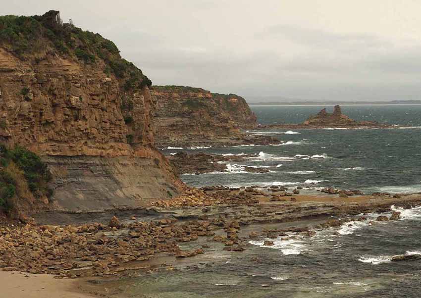
| Consultants Hassell Studio admit the section between Cape Paterson and Inverloch remains unresolved. While the initial vision was for walkers and cyclists to follow the coast, creating a new path would require the removal of rare and valuable vegetation. One option is to make the road one-way for cars, reduce the speed limit to 40km/h, and convert the other side to a walking and cycling trail. The report notes, however, “Walking and cycling so close to the road may still be experienced as unsatisfying and dangerous.” An option favoured by local environmentalists – but not by the politicians spruiking “a coastal walk” – is to extend the existing cycling/ shared travel path from Wonthaggi to Inverloch via a new “inland route”. |  The draft plan is open for community feedback until May 16. Consultants will be available at Inverloch Community Hub on Saturday April 24, 10am-1pm You can also comment online or fill out a survey at Engage Victoria. |
In other places, Hassell Studio proposes a range of actions to protect and enhance fragile environments by making use of existing trails and goat tracks where possible and using boardwalks over sensitive flora, fauna and water systems.
Every section of the trail has its own unique challenges. For instance, the boardwalks and viewing platforms proposed for the Wetland Walk between Kilcunda and Powlett River will need to be elevated above the maximum anticipated water level or periodic inundation factored into the experience.
They say the park will evolve over time due to natural changes that shape the coast, the way local villages and towns interface with the park and new services and businesses such as shuttle services and bike hire that will grow around the visitor experiences.
A specific app for users of the trails could recommend walking times on beaches and appropriate experiences.
The proposed cycling route uses the existing shared user path system comprising the Bass Coast Rail Trail and the Phillip Island Road Shared Use Trail, then diverts via the Powlett River Road, across the Victorian Desalination Plant and associated trails and connect back into the West Area and Haulage Hill line [West Area Road] into Wonthaggi.
The report envisages a cultural centre at West Area encompassing the mining history of the area and its new focus as an arts centre,
From Wonthaggi, existing 4WD tracks through the Wonthaggi Heathlands can be upgraded to become shared use trails with cycling opportunities down to Harmers Haven. From here, cyclists are directed to local roads to connect into Cape Paterson.
An alliance of resident and friends groups is still digesting the draft plan, which is open for community feedback until May 16.
Not too coastal, urges alliance
July 31, 2020 - Yallock-Bulluk trail between San Remo and Inverloch ‘shouldn’t hug the coast’