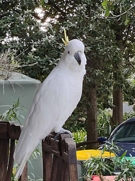
 Residents of Bass Coast’s coastal hamlets value their connection to nature. Photos: Emily Clarke
 WITH bushfires and now floods affecting our nation, it’s become clear that climate change is here. Sadly, we must acknowledge that Bass Coast Shire and the surrounding region is the most denuded in the state with many areas suffering complete removal of native flora and fauna and increasing coastal erosion over the past decade.
In recent years, federal, state and local governments have been changing policy in regards to our environmental values, broadly identifying the urgent need to protect, preserve and expand upon our various working ecologies. In 2018 the Victorian Government released amended Planning Practice Notes for the Planning and Environment Act 1987 setting out the maximum proportion of the site that can be developed on house blocks. This was done to address overdeveloped estates that visually change a town’s character and create localised thermal heat masses with no trees and minimal air flow between buildings.
As we're all aware, to stand up and recognise climate change is to question, challenge and change planning practices that are outmoded and to deliver site-appropriate solutions that preserve our unique environment into the future.
Again in Victoria, the Department of Environment, Land, Water and Planning has finally released a draft statement of planning policy for comment under the Bass Coast Distinctive Area & Landscape (DAL) project. The crucial point was to identify, preserve and maintain the intrinsic coastal qualities of each coastal hamlet by preventing urban-style developments. Bass Coast Shire Council will incorporate the final document within the Bass Coast Shire Planning Scheme.
So how do our council’s actions stack up in terms of recent planning outcomes and those currently up for consultation?
Not very well on the Keams Estate development in San Remo, where flooding occurred on adjacent properties after the council permitted mass removal of the vegetation on the site and an inadequate water catchment area and lower side drainage. Additionally, against the current Planning Practices, the council approved hard surface development beyond the allowable limits. This will add to the runoff into the bay and limit the opportunity for adequate revegetation.
Two current applications beg for serious attention. An application for Langard Road, Cowes seeks to fill in a natural spring-fed dam (connected to many underground aquifers throughout Cowes), to remove crucial foreshore flora (that protects the foreshore from erosion and inundation) to build a seven-storey set of apartments.
The northern beaches on Phillip Island already suffer heavy erosion and are faced with future inundation with only the tertiary dunes remaining. Any loss of the coastal flora and overdevelopment on this site presents an incalculable risk.
Similarly, the developers for 35 Cowes-Rhyll Road, Cowes seek to fill in yet another well-known local spring-fed dam of crucial ecological significance. AGAIN, connected to aquifers throughout the Cowes township, with a risk to local wildlife, underground water supply and potential inundation.
 Wildlife and humans can co-exist.
 The council’s proposed road scheme for Surf Beach and Sunderland Bay contradicts this policy framework. Publicity, plans and a letter to residents makes it clear the council seeks to urbanise our unique coastal estate with intent. Before asking for responses to the road scheme, they state that BCSC is about to embark on the most expensive road scheme in the history of the Bass Coast Shire in Surf Beach and Sunderland Bay.
The design framework options fail to recognise Surf Beach and Sunderland Bay Estates as valuable coastal hamlets abutting the Nature Park and coastline and the shearwater rookeries protected by the international RAMSAR treaty.
More lights and urban style roads throughout the estate would only attract more drivers and faster road speeds. Low lighting is an asset and part of the intrinsic value of any coastal hamlet. It facilitates the connection to nature with reduced light pollution, great night skies and stars, supporting our abundant wildlife's ability to move around at night for food and water from the rookeries to the farmlands and “Chinaman's Estate” (Scenic Estate Conservation Reserve) over the road. As it is, long-time residents of these estates draw their curtains at night as the shearwaters are also attracted to the lights in the houses.
Most residents just want to stop the dust, caused mostly by speeding drivers. The new speed signs are having a good effect. Asphalt roads with kerb and channelling would immediately urbanise the area, devaluing its value as a coastal hamlet.
Considering climate change again, asphalt roads also increase thermal heat mass in summer and water flow to the drains. Kerb and channelling is urbanisation and inappropriate in ecologically sensitive areas. Our wildlife rely on roadside water for their survival in these estates as are our trees and water tables. Interlocking road pavers, as used in Silverleaves and Cape Woolamai esplanades, are cheaper to make, install and repair, are heavy load bearing, have colours more suitable for a coastal look and heating climate whilst allowing water to soak into the ground.
We live in uncertain times. Many Bass Coast people are struggling financially and feeling concerned about the future. But as this is happening people are also reconnecting with their community and our unique environment. The DAL Program is a crucial and timely document seeking to protect these values into the future. The council should defer any decision on the road plan until it is finalised.
Emily Clarke lives at Surf Beach