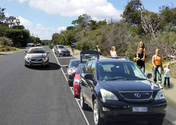
 A shared pathway incorporating 138 parking bays, will require the removal of coastal vegetation. Image: Bass Coast Council
 By Aileen Vening
THIS week I attended the council’s environment advisory committee meeting and showed images of changes at Inverloch beach since 2004.
The purpose of the meeting was to persuade the council to defer the second stage of the shared pathway at least until a local coastal hazard study has been completed.
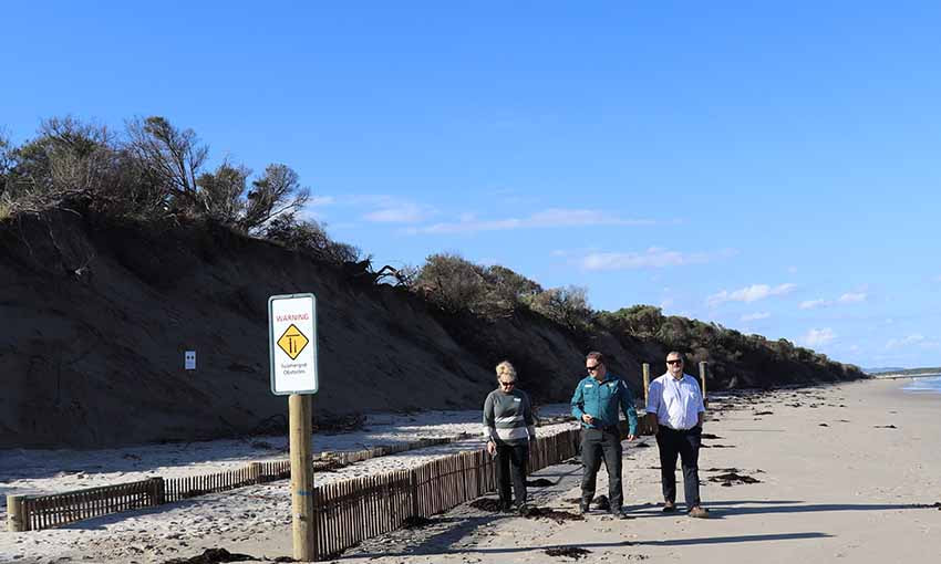
Inverloch surf beach has lost up to 40 metres of sand, as well as dune vegetation, in the last few years, leaving sand cliffs six metres high.
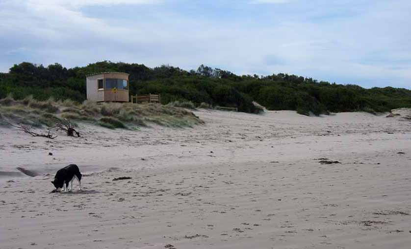
One outcome of this has been the impact on the Inverloch Lifesaving Club lookout towers. The original tower was undermined by erosion and removed in October 2013. The foundations of its replacement, installed in December 2014, were exposed by storms in May 2015; sandbagging provided protection for a year before the building had to be put on skis and moved again. Since then it has been moved twice and is now being dismantled.
A thin strip of sand and vegetation remains to protect the clubrooms and a section of the Bunurong Road.
The recent public consultation on the path gave people two options – one would lead to 2000-plus square metres of roadside foreshore reserve vegetation being removed and the other 4000-plus square metres.
A lot has changed since the original path plan was approved – maybe five years ago – and the idea that any vegetation would be removed when so much is being lost on the ocean side is ridiculous.
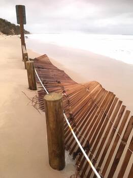
 Inverloch sand fence, following the April 26 storm. Photo: Vicki Bradley
 Anderson Inlet has been described as the most dynamic estuary on the Victorian coastline; this may explain the title of Lis Williams’ book about Inverloch ‘Shifting Sands’.
Change, whether caused by varying flows down the Tarwin River, tides coming and going, ocean wind and waves eroding and depositing sand at Point Smythe or elsewhere, has always been a feature. Human impacts have included the introduction of spartina to Anderson Inlet, construction of walls, the jetty, and stormwater drains.
Long-term residents describe where the water used to go, where there was vegetation, when and why jetties have been rebuilt.
Change today has a new element – our climate is changing. The impacts of this are now evident along the Inverloch surf beach and in Anderson Inlet. Sea level is rising about 2-3 mm per year – not comparable to the 7-8mm a year in the Gulf of Carpentaria, but year after year it builds to a significant amount.
When a high tide coincides with a storm event with strong winds from the south west, there is greater impact on the dune system. Coastal tea tree that helps stabilise sand dies once it is inundated with salt water – this explains the amount of tea tree that has been transported east into Anderson Inlet.
These events don’t happen frequently but the impact of each one on a destabilised dune system can be significant.
As manager of this stretch of coastline, the council has installed wet sand fencing at two locations where important assets are now under threat – the Inverloch Surf Lifesaving Clubhouse and Bunurong Road near Surf Parade. This is designed to slow incoming waves and allow sand to build up between the fence and the dune. This has been implemented successfully at Port Fairy. These fences are ‘soft engineering’. Council intends to take sand from Anderson Inlet to replenish the dunes behind the fences, and hope to be able to revegetate at a later date.
Since the fences were installed there have been two storm/high tide events that have tested their effectiveness – the second, on April 26, washed away one of the fences.
Installation of rock walls would be far more expensive and contribute to the loss of more sand as waves bounce off, dragging the sand back to the ocean.
Aileen Vening delivers coastal geography and climate change education programs for the South Gippsland Conservation Society. She has been photographing and observing changes along the Inverloch coast for several years.

