By Catherine Watson
WOULD you rather save the Inverloch surf beach or the Bunurong Road? Because you probably can’t save both.
The release of detailed mapping of the Inverloch coast as part of the Cape to Cape Coastal Resilience Project has set the scene for some serious decision making over the next year.
WOULD you rather save the Inverloch surf beach or the Bunurong Road? Because you probably can’t save both.
The release of detailed mapping of the Inverloch coast as part of the Cape to Cape Coastal Resilience Project has set the scene for some serious decision making over the next year.
The maps are based on the existing Land Subject to Inundation Overlay created in 2017. They factor in sea level rises of between 0 and 0.8 metres over the next 80 years and indicate permanent and temporary inundation under various scenarios including storm surges, storms and king tides.
For Inverloch residents wanting to know if their house is going to be under water in 10 years, the answer is probably not. The maps are not detailed enough to indicate individual houses but they show almost all of the town’s residential areas remaining above the line of inundation.
At a media briefing last week, the Coastal Resilience team explained that what’s most a risk is infrastructure – roads, public buildings and footpaths. And that choices will have to be made.
Hazard bands in the modelling indicate areas potentially at risk from coastal hazard events, but do not represent a predicted loss of coastal land or loss or damage to values and assets. The data will be used for long-term planning based on science, technical assessments and community aspirations.
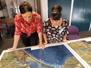
 Bass MP Jordan Crugnale, left, is briefed on the Inverloch coastal mapping by Cass Philippou of the Department of Environment, Land, Water and Planning, part of the project team.
 The team stressed that the mapping is conservative – that is, like recent COVID modelling, it is based on a worst case scenario. And it is based on no intervention – if nothing was done, which is unlikely to be the case.
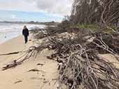
There’s also the unpredictability of nature, including the movement of sand in Andersons Inlet. Over the past decade, up to 70 metres of the vegetated dunes that existed behind Inverloch Surf Beach in 2012 have been swept away.
But this summer’s incessant easterlies have actually been helpful in restoring some sand. And while sand dune erosion has continued, the rate of increase actually slowed in 2019-20.
The next step for the project team is to survey the community on how they use the beach and what’s most important to them. Is it surfing, is it walking your dog on the beach, teaching your kids to swim? What places are important and what places can we let go?
People are already changing the way they use the beach because the environment is changing. You wouldn’t try and walk on the surf beach at high tide because there is so little beach left.
One thing that’s clear after many years of human intervention: every human intervention has side-effects, and it’s better to consider the consequences first. If you put in a rock wall, there goes your beach.
You may be able to save the surf beach but it could mean sacrificing Bunurong Road in its current location. That’s not an insoluble problem. It could be moved further inland, as could other assets such as Rotary Park.
The Surf Parade pathway extension may be under water in 15 years. That doesn’t mean you don’t build it but the community may have to accept that it’s a temporary path. Or they could decide it’s better to move it to the other side of the road or even the next street.
On present trends, it’s probably impossible to save the surf beach in perpetuity, but it might be possible to keep it for another 10 or 15 years, using various interventions such as sand renourishment, geotextile bags and wet sand fences.
More information is available at Cape to Cape Resilience Project.

Time is running out
Dec 16, 2021 - Dec 15, 2021 - The next few months are critical in the fight to save the Inverloch surf beach, writes Philip Heath
Dec 16, 2021 - Dec 15, 2021 - The next few months are critical in the fight to save the Inverloch surf beach, writes Philip Heath