By Dave Sutton
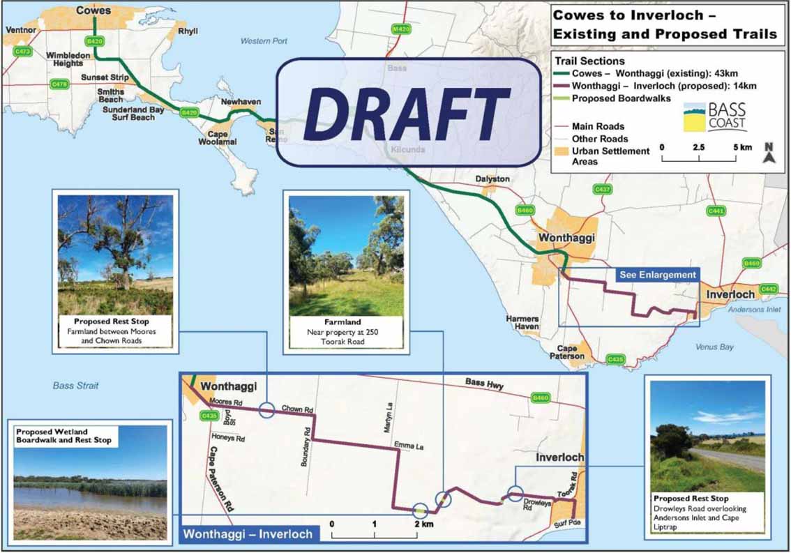
THE Wonthaggi-Inverloch inland shared pathway was proposed a number of years ago utilising the unused road reserves between Wonthaggi and Inverloch. I have long advocated that these unused road reserves would be an ideal biolink across the landscape that would retain the existing intact indigenous remnant vegetation, provide good habitat for native fauna and, with careful planning, could double as a cycle/walking trail between the two townships.
The design of the shared pathway could and should retain the existing remnant vegetation and cater for the cycle/walking trail alongside existing vegetation and use the opportunity to plant additional indigenous vegetation that would include overstorey, mid-storey and groundcover plants. I do, however, have serious reservations about the current plan being put forward by the council.
The plan will encroach on significant remnant vegetation which has high biodiversity values and provides excellent habitat for indigenous mammals, reptiles, birds and insects. The plan fails to recognise the value of the native vegetation and the eco-services it provides for native fauna species.
I estimate the length of the latest published version of the trail, in areas where the most significant remnant vegetation remains relatively intact, is approximately 3km in length x 20.12 metres wide (the width of most unused road reserves) which equals 6.04 hectares of prime bushland.
The proposed trail would cut though the remnant vegetation, effectively dividing it into two parallel corridors of vegetation. It is unclear how wide the path would be but it would need to be wide enough to cater for cyclists.
| Assuming the path is to be one of the widths below, vegetation loss is calculated to be as follows:
None of this is acceptable. To further fragment an already highly fragmented landscape in 2022 when we know that loss of biodiversity, through clearing of vegetation at a global scale, is contributing to climate change should not be an option. If this was to proceed, the resilience of the remaining vegetation would be lost through weed invasion, change of hydrology and reduction of the tree canopy in an already narrow strip, causing drying out of the understorey. Any remaining biodiversity values would be considerably diminished. It is worth noting:
I see the inland trail as an opportunity to get the landowners on board and achieve a net vegetation gain as opposed to a net loss of a significant area of valuable biodiversity. I am aware of at least one landholder alongside the trail who would consider giving up a corridor of their pasture for the trail if it meant retaining remnant vegetation. Others could possibly agree to do the same or be open to strategic land purchases if the existing vegetation is retained and revegetation is undertaken as a significant high priority component of the project. Land clearing is death by a thousand cuts. We live in a world of rapid climate change and we are going to need to retain every tree possible for a sustainable future. | Coastal won't work By Danny Drummond Regarding the two options for a track from Wonthaggi to Inverloch – inland or coastal – the issues of public land management are more complex than some commentators may think. It’s important to note the Bunurong coast is a State Park with strict planning controls. The inland option is through unused road reserves leased for grazing. The concept for a walking/cycle track along unused road reserves between Wonthaggi and Drowleys Road goes back more than 20 years. The then Department of Conservation and Natural Resources called for ideas to create a track from Phillip Island to Wilsons Prom. It was recognised back then that the Bunurong coast from Cape Paterson to Inverloch was not suitable for a number of environmental reasons. It would require vegetation clearing along its full length with few options for offset planting. There are also a number of endangered species along that coast. The road reserve option, on the other hand, required less vegetation clearing plus the existing cleared sections would be replanted, providing far more habitat than was lost. A wildlife corridor being created the whole way. Where the road reserve is fully vegetated there may be options to place the track on cleared adjacent land in consultation with adjoining landowners. This track will provide a peaceful ride free of traffic noise for tourists and locals. It will be a great asset for Bass Coast. Danny Drummond is a former Parks Victoria ranger who was involved in early planning for the pathway. 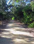 Inland pathway back on track Sept 24, 2021 - 20 years ago Danny Drummond drew a mud map of a cycle and walking track linking Wonthaggi and Inverloch. 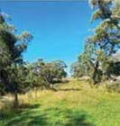 Same old story Feb 11, 2022 - When Frank Coldebella saw the front page headlines about a bike path in the Sentinel Times, he had a sense of deja vu. |
To remove vegetation is easy, but to revegetate … and more of it is needed … is a difficult process that can take decades for many plants to reach maturity, especially large, old-growth trees that provide vital habitat hollows for numerous fauna species. Revegetation adjacent to remnant vegetation will, over time, improve biodiversity values and overall resilience to climate change.
The council website states:
Vegetation ‘offsets as per state government requirements’ cannot, and do not provide net gain of native vegetation. It is simply a process that protects another area of vegetation, not necessarily within the local area, and often not even the same vegetation community, in exchange for removing/destroying high value indigenous vegetation. This is a net loss of vegetation.
The Gippsland Threatened Species Action Group, of which I am a member, has been looking at using the unused road reserves as an east-west wildlife corridor for threatened fauna species. This includes the critically endangered Lace Monitor, which has been sighted in places along the proposed trail, the Southern Brown Bandicoot and the Growling Grass Frog. To date, there have been very few wildlife surveys undertaken in this general area. Landcare staff have undertaken some wildlife monitoring in the immediate area and our group has strategically placed acoustic recording monitors to ascertain the presence or otherwise of any listed threatened species recorded for the area.
I have highlighted a number of issues above re the proposed pathway - the issues raised are not insurmountable but more discussion is required between all stakeholders in the near future.
Dave Sutton is a former president of the South Gippsland Conservation Society and a member of the Gippsland Threatened Species Action Group.
The council website states:
- ‘Where the path does run through existing vegetation, an avoid and minimise principal has been applied to minimise the amount of vegetation being removed. It is not possible to achieve the above. There is 3km of relatively intact vegetation that no matter how or where the path is placed will split the vegetation into two distinct corridors opening the canopy up as noted above.
- ‘Any vegetation removal that takes place will be offset as per state government requirements and additional native vegetation planting will take place where the path runs through cleared farmland’
Vegetation ‘offsets as per state government requirements’ cannot, and do not provide net gain of native vegetation. It is simply a process that protects another area of vegetation, not necessarily within the local area, and often not even the same vegetation community, in exchange for removing/destroying high value indigenous vegetation. This is a net loss of vegetation.
The Gippsland Threatened Species Action Group, of which I am a member, has been looking at using the unused road reserves as an east-west wildlife corridor for threatened fauna species. This includes the critically endangered Lace Monitor, which has been sighted in places along the proposed trail, the Southern Brown Bandicoot and the Growling Grass Frog. To date, there have been very few wildlife surveys undertaken in this general area. Landcare staff have undertaken some wildlife monitoring in the immediate area and our group has strategically placed acoustic recording monitors to ascertain the presence or otherwise of any listed threatened species recorded for the area.
I have highlighted a number of issues above re the proposed pathway - the issues raised are not insurmountable but more discussion is required between all stakeholders in the near future.
Dave Sutton is a former president of the South Gippsland Conservation Society and a member of the Gippsland Threatened Species Action Group.