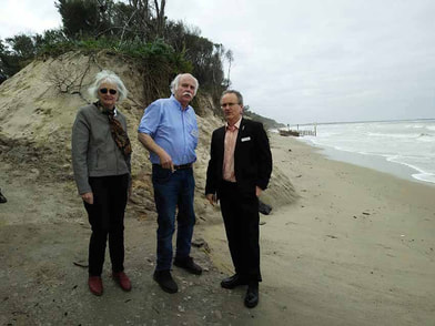
 Ecologist Alison Oates, South Gippsland Conservation Society vice president Dave Sutton and Marine and Coastal Council chair Anthony Boxshall inspect the beach after the launch of the report. The wet sand fencing trial can be seen in the background.
 By Catherine Watson
WE ARE in uncharted waters when it comes to understanding what’s happening to the Inverloch beaches, according to geomorphologist Neville Rosengren.
He made the comment at the Inverloch Surf Lifesaving Club yesterday as the South Gippsland Conservation Society launched a major report that called for a range of short-term and long-term measures to address or slow Inverloch’s coastal erosion.
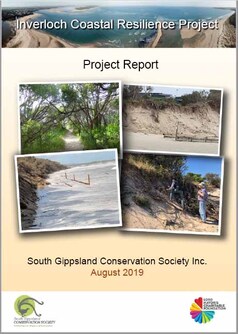
The Inverloch Coastal Resilience Report, the culmination of 12 months of investigation and consultation, draws on specialist consultant studies in geomorphology, ecology, cultural heritage and economics commissioned for the project.
WE ARE in uncharted waters when it comes to understanding what’s happening to the Inverloch beaches, according to geomorphologist Neville Rosengren.
He made the comment at the Inverloch Surf Lifesaving Club yesterday as the South Gippsland Conservation Society launched a major report that called for a range of short-term and long-term measures to address or slow Inverloch’s coastal erosion.
The Inverloch Coastal Resilience Report, the culmination of 12 months of investigation and consultation, draws on specialist consultant studies in geomorphology, ecology, cultural heritage and economics commissioned for the project.
Project leader Philip Heath urged the State Government and Bass Coast Shire Council to consider the findings and recommendations in future planning for the Inverloch coast.
The audience of residents and scientists included the chair of Victoria’s Marine and Coastal Council, Anthony Boxshall, who applauded the quality of the SGCS report. “It’s highly unusual to get such a substantial piece of evidence-based research from a community organisation. You’ve brought all the decision makers together.”
The report found the beach had receded by six metres a year since 2013, one of the most rapid changes along a sandy coastline in Victoria in European times, and rated as ‘severe’ to ‘extreme’ by global comparison. The recession has accelerated over the past year.
Dr Rosengren said talking of “cycles” was not helpful in understanding what was happening on the beach. While the shoreline changes are probably caused by rising sea levels and more frequent and more intense storms, something else is also occurring that scientists don’t fully understand,
In previous beach erosion events, sand from the surf beach was deposited offshore. Now it’s being deflected into Anderson Inlet, creating sand barriers in the inlet and reducing the quantity of sand available for natural beach renourishment.
An economic study assessed the likely impacts of the disappearing beach on the local economy at $3 to $5 million. Inverloch’s Aboriginal cultural heritage is also at risk with four sites reflecting an occupation period of some 7000 years at risk from destabilisation of the dunes.
Ecologist Alison Oates found that almost half the dune system vegetation has been lost since 2013. At yesterday’s launch she described visits to Flat Rocks where the mature coast banksia trees were disappearing before her eyes.
She said the coastal vegetation was one of the few east-west biolinks in the region,
acting as an important corridor for wildlife movement along the coast, as well as for wildlife movement between the coast and hinterland areas.
She recorded the loss of incipient dunes (foredune) between Flat Rocks to just west of Point Norman, resulting in complete loss of suitable nesting habitat for vulnerable shorebird species, including hooded plovers.
Ms Oates said no further native vegetation should be removed from the Inverloch dune system, including the rear dunes adjacent to Surf Parade.
The report recommends a range of short-term measures to address erosion, including revegetation with appropriate native species, dune renourishment, thatching of steep dune slopes with eroded tea tree branches and debris, effective weed and pest control, rationalising of beach access tracks and educating beach users not to trample on the dunes.
It also recommends extending the current wet sand fencing trial to 100 metres and a 45 degree turn at the western ends of each section.
It calls for a Local Coastal Hazard Assessment (LCHA)) to identify feasible longer-term strategies to manage future surf beach erosion and Inlet accretion events.
“It is crucial that investigations commence as soon as possible, otherwise the environmental, social and economic values identified in this report will have been lost before any longer-term measures have been identified.
A key element of future studies will be to analyse the complex relationships between offshore coastal processes, Anderson Inlet and Point Smythe, including sources and dynamics of sand for the entire coastal area and tidal dynamics to determine sand pathways on ebb and flood tides.
Mr Boxshall said the default response to coastal encroachment was the idea of protecting assets with engineering interventions but humanity had to adapt to a new normal where storms could no longer be dismissed as “freak”.
“We could live behind sea walls. The Dutch have done it for decades. But most of the things people love and want to protect will have to go.”
He said the reality was that residential areas in parts if Victoria will soon be under water. “It’s a conversation we need to have. It has got to be enabled by a statewide approach and we need leaders at local government level to have confidence to act.”
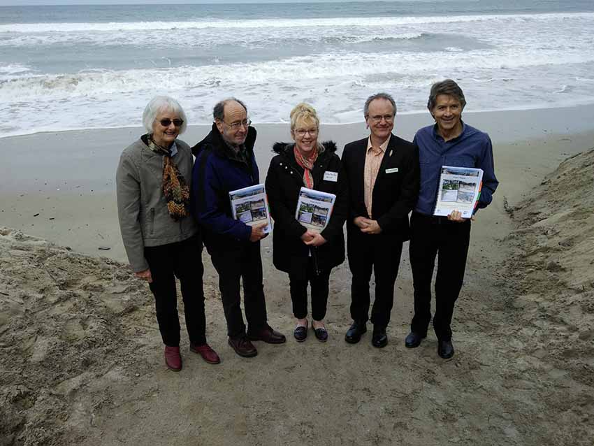
Ecologist Alison Oates, geomorphologist Neville Rosengren, DELWP’s Carole McMillan, Marine and Coastal Council chair Anthony Boxshall and project leader Philip Heath.