 From Bass Coast to Bells Beach, coastal councils are struggling to respond to local flood risks and coastal erosion.
 By Michael Whelan
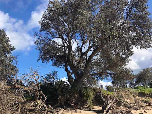
AS YOU return to our Bass Coast beaches in the coming months many of you may be distressed to see the impact of coastal erosion.
In 2019, we declared a Climate Emergency and developed a comprehensive Climate Change Action Plan to cut our community’s emissions to zero by 2030. This plan also includes adaptation to respond to climate impacts, one of those being coastal erosion.
The State Government’s latest modelling has confirmed our concerns, that unless serious action is taken now, coastal erosion will impact dozens of houses in Inverloch in coming decades.
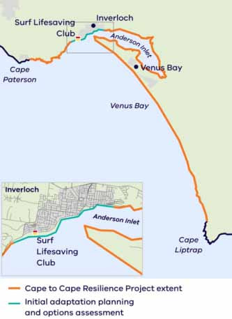
Maps modelling the impact of climate change on Inverloch, released as part of the Department of Environment, Land, Water and Planning (DEWLP) “Cape to Cape Resilience Project” show that, without intervention, erosion will cover hundreds of metres of Surf Parade, Inverloch, and eat into about a dozen private properties as the sea level rises 0.5 metres by 2070.
As early as 2040, the modelling shows the Inverloch Surf Lifesaving Club building surrounded entirely with a 0.2 metre sea level rise. By 2100, erosion would reach more than 40 houses at Surf Parade and beyond with a 0.8 metre rise.
Erosion also threatens popular Phillip Island beaches.
As early as 2040, the modelling shows the Inverloch Surf Lifesaving Club building surrounded entirely with a 0.2 metre sea level rise. By 2100, erosion would reach more than 40 houses at Surf Parade and beyond with a 0.8 metre rise.
Erosion also threatens popular Phillip Island beaches.
 Inverloch Region Coastal Hazard Assessments | DELWP is consulting the community as it considers more rock walls, sand renourishment and even realigning or raising sections of road in Inverloch, but there is much more that needs to be done. We may not like to talk about it, but a planned retreat of public assets, and potentially even houses, may need to be considered among the options. Bass Coast is not alone, of course. This is a crisis shared by almost every other coastal council in Victoria, around Australia and the world, from Bells Beach to Massachusetts in north-east of the United States and beyond. That’s why at last week’s Municipal Association of Victoria State Council meeting, Bass Coast Council put forward a motion requesting the Victorian Government urgently integrate environment and climate change policy into Victorian planning schemes and develop a state-wide Flood Mapping system and Flood Management Overlay. |
The Victorian Government’s current position is to leave it to local councils to update flood mapping and controls in their planning scheme.
Limited support has been provided by the State Government to some councils to help them developed flood studies and tools to help councils manage and respond to local flood risks and coastal erosion.
This system and overlay should be regularly reviewed and updated to reflect our changing environment and the impacts of climate change.
Inundation and coastal erosion are natural disasters that pose a significant threat to life, the environment and the economy.
Many councils do not have the resources or capability to undertake such work. It is both logical and feasible for an overarching state-wide flood inundation overlay to be developed by the Victorian Government.
The Victorian Government demonstrated leadership in the aftermath of the 2009 Black Saturday Bushfires by implementing a Victoria wide Bushfire Management Overlay. There is now a desperate need for a similar overlay to respond to the climate emergency and projected flood inundation and coastal erosion across Victoria.
Whether it’s informing a staged retreat, coastal protection, or just managing growth and development; our communities need access to up to date information and modelling so we can make wiser decisions for our future.
Michael Whelan is Bass Coast Mayor.